Obiekt
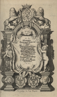
Tytuł: Topographia Bohemiae, Moraviae et Silesiae, das ist Beschreibung und eigentliche Abbildung der Vornehmsten und bekandtisten Stätte und Plätze in dem Königreich, Boheim und eimerleibten Ländern, Mähren und Schlesien
Opis:
192 strony, [9] kart : ilustracje miedziorytowe ; 2˚ ; Cytata bibliograficzna: Estreicher XV-XVIII, 35, 219 ; Cytata bibliograficzna: VD 17 online, 23:301612X ; Druk dwuszpaltowy ; Frontispis miedziorytowy, 3 miedziorytowe mapy, 34 tablice miedziorytowe ; Indeks i wykaz map ; Oprawa: ciemnobrązowy półskórek, na grzbiecie złocony tytuł ; Polonicum: mapa Śląska, opisy i widoki miast śląskich
Wydawca:
Verlegt durch Matthaeum Merian
Miejsce wydania:
Współtwórca:
Merian, Matthäus (1593-1650). Nakładca
Identyfikator zasobu:
Identyfikator oryginału:
Język:
Prawa do dysponowania publikacją:
Wojewódzka Biblioteka Publiczna w Opolu
Kolekcje, do których przypisany jest obiekt:
Data ostatniej modyfikacji:
2024-12-06
Data dodania obiektu:
2024-12-06
Liczba wyświetleń treści obiektu:
112
Liczba wyświetleń treści obiektu w formacie PDF
44
Wszystkie dostępne wersje tego obiektu:
https://www.obc.opole.pl/publication/23836